
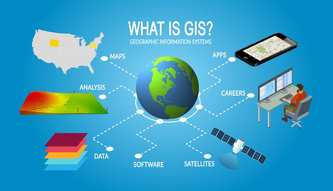
GIS software (or Geographic Information Systems software) is a powerful tool that helps people visualize, analyze, and manage geographic data. It allows users to map out information like land use, terrain, and population density, and then use that data to make strategic decisions. GIS software is used in a variety of industries, such as urban planning, engineering, and environmental protection.
What is GIS Software?
GIS software is a digital tool that helps to turn complex data into interactive, visual maps. It is designed to help users to quickly analyze, manage, and visualize geographical information. With GIS software, users can easily map out information like land use, terrain, and population density.
Read Error 0x0 0x0?- Exactly how to fix it? Special Explanation
GIS software is used by a variety of organizations and industries, such as government agencies, universities, and businesses. It helps organizations to make informed decisions by providing data that can be used to analyze and predict trends. GIS software can also be used to identify areas of risk or opportunity, plan out new projects, and monitor the success of current projects.
Benefits of Using GIS Software
Using GIS software has a number of benefits, including the ability to:
- Save time. GIS software allows users to quickly collect, organize, and analyze data. This can help to save time and money when planning projects or making decisions.
- Accurately map out geographical information. GIS software makes it easy to accurately map out geographical information, such as terrain, population density, and land use.
- Make informed decisions. GIS software helps organizations to make informed decisions by providing data that can be used to analyze and predict trends.
- Monitor progress. GIS software can be used to monitor the progress of projects, which can help organizations to ensure that projects are on track and within budget.
- Identify areas of risk or opportunity. GIS software can help to identify areas of risk or opportunity, which can be useful when planning new projects or making decisions.
Different Types of GIS Software
There are several different types of GIS software available, including desktop, web-based, and mobile.
Desktop GIS software is a powerful tool that is typically used by professionals in the field. It is installed on a user’s computer and is capable of handling large amounts of data. Desktop GIS software is typically used by organizations that need to analyze complex data and make informed decisions.
Web-based GIS software is a cloud-based solution that allows users to access data from any location. It is typically used by organizations that need to share data with multiple users or partners. Web-based GIS software is often used by businesses, government agencies, and universities.
Mobile GIS software is designed for use on smartphones and tablets. It is typically used by individuals who need to access data while on the go. Mobile GIS software is often used by field teams, such as surveyors and engineers, who need to access data while in the field.
5 Best GIS Software Companies
GIS software companies provide a range of sophisticated tools to help organizations analyze, create, and display geographic data. With the right GIS software, organizations can gain insights into their data, better understand their customers, and make informed decisions. With so many GIS software companies out there, it can be difficult to choose the right one. To help you make an informed decision, here is a list of the 5 best GIS software companies.
First on the list is Esri. Esri is the leading provider of GIS software, with a wide range of products and services. They offer desktop, web, and mobile GIS solutions, as well as cloud-based GIS applications. They also provide a range of training programs and support services. Esri is the ideal choice for organizations looking for a comprehensive GIS solution.
Second on the list is Autodesk. Autodesk is a leading provider of GIS software for design, engineering, and construction professionals. They offer a range of powerful GIS tools, including 3D mapping, automated analysis, and visualization. Autodesk also provides a range of training and support services.
Third on the list is MapInfo. MapInfo is a leading provider of GIS software for business and government organizations. They offer a range of powerful GIS tools and services, including data management, analysis, and visualization. They also provide a range of training and support services.
Forth on list is IamGIS. IamGIS provides a range of GIS software tools and services, as we can read on FintechZoom, including data management, spatial analysis, mapping, and other advanced GIS software capabilities. The company also provides custom GIS software development services, helping customers develop GIS applications that are tailored to their specific needs. With years of experience in GIS software development, IamGIS is one of the most reliable GIS software companies in the market.
Finally, on the list is Quantum GIS. Quantum GIS is an open-source GIS software that is free to use. It is a powerful GIS tool that can be used for data analysis, visualization, and mapping. It is ideal for organizations looking for a low-cost solution.
In conclusion, these are the 5 best GIS software companies. Each of these companies offer a range of GIS solutions and services, so choosing the right one is the key to success. With the right GIS software, organizations can gain insights into their data, better understand their customers, and make informed decisions.
GIS Software Market Overview
The global GIS software market is estimated to be worth $7.7 billion, and is projected to grow at a compound annual growth rate of 8.8%. The growth of the GIS software market is driven by the increasing demand for GIS data and the ability to quickly analyze and visualize data.
The global GIS software market is divided into four major segments: desktop, web-based, mobile, and open-source. The desktop segment is the largest, accounting for more than half of the market share. The web-based and mobile segments are growing rapidly, driven by the increasing demand for cloud-based solutions and mobile applications. The open-source segment is the smallest, and is expected to remain small as most GIS software vendors prefer to develop proprietary solutions.
Popular GIS Software Packages
There are a number of popular GIS software packages available, including ArcGIS, MapInfo, and QGIS.
ArcGIS is a powerful GIS software package developed by Esri. It is used by a variety of organizations, including government agencies, universities, and businesses. ArcGIS is capable of handling large amounts of data and is used to visualize, analyze, and manage geographic data.
MapInfo is a GIS software package developed by Pitney Bowes. It is used by businesses and government agencies to create detailed maps and analyze data. MapInfo is easy to use and offers a variety of features, such as 3D visualization, routing, and terrain analysis.
QGIS is an open-source GIS software package developed by the Open Source Geospatial Foundation. It is used by a variety of organizations, including businesses, universities, and non-profits. QGIS is a powerful tool that can be used to create detailed maps and analyze data.
How to Choose the Right GIS Software for Your Needs
Choosing the right GIS software for your needs can be a daunting task. Here are some tips to help you make the right choice:
- Determine your needs. Before you start looking for GIS software, it’s important to determine your needs. Think about what type of data you’ll be working with, how you’ll be using the data, and what features you need.
- Evaluate different GIS software packages. Once you’ve determined your needs, it’s time to start evaluating different GIS software packages. Look for packages that offer the features you need and are within your budget.
- Consider the support options. GIS software can be complex and difficult to use, so it’s important to consider the support options. Look for vendors that offer training and support services, as well as updates and upgrades.
- Ask for a demo. Before making a purchase, it’s a good idea to ask for a demo of the GIS software. This will allow you to test out the features and make sure it meets your needs.
Important Features to Look for in GIS Software
When looking for GIS software, there are several important features to look for, including:
- Data analysis tools. GIS software should have powerful data analysis tools that can help you quickly analyze and visualize data.
- Visualization tools. GIS software should have visualization tools that can help you create detailed maps and graphics.
- Automation. GIS software should have automation capabilities that can help you save time and money.
- Collaboration tools. GIS software should have collaboration tools that can help you share data with other users or partners.
- Security. GIS software should have security features that can help protect your data and prevent unauthorized access.
Tips for Getting the Most Out of GIS Software
Getting the most out of GIS software requires an understanding of the features and a willingness to explore. Here are some tips to help you get the most out of GIS software:
- Understand the features. GIS software is a powerful tool, but it’s important to understand the features and how to use them. Take time to learn about the features and practice using them.
- Use data sources. GIS software is only as good as the data it’s using. Make sure to use reliable data sources to ensure accuracy.
- Keep up with updates. GIS software is constantly evolving, so it’s important to keep up with updates and new features.
- Use visualization tools. GIS software has powerful visualization tools that can help you create detailed maps and graphics.
- Automate processes. GIS software has automation capabilities that can help you save time and money.
GIS Software Resources
If you’re looking for more information about GIS software, there are a number of resources available. Here are some of the best GIS software resources:
- Esri’s GIS Software Guide: Esri’s GIS software guide provides an overview of the different types of GIS software, as well as tips for choosing the right software for your needs.
- MapInfo’s GIS Software Guide: MapInfo’s GIS software guide provides an overview of the different types of GIS software, as well as tips for choosing the right software for your needs.
- QGIS Documentation: The QGIS Documentation provides an overview of the different features of the QGIS software, as well as tutorials and best practices.
- GIS Software Reviews: GIS software reviews provide an unbiased look at the different GIS software packages.
- GIS Software Blogs: GIS software blogs provide tips and tricks for getting the most out of GIS software.
Conclusion
GIS software is a powerful tool that helps people visualize, analyze, and manage geographic data. It is used in a variety of industries, such as urban planning, engineering, and environmental protection. There are several different types of GIS software available, including desktop, web-based, and mobile.
When choosing GIS software, it’s important to determine your needs and evaluate different packages. Look for packages that offer the features you need and are within your budget. It’s also important to consider the support options and ask for a demo before making a purchase.
Finally, it’s important to understand the features and use data sources to ensure accuracy. Keep up with updates and use visualization tools to get the most out of GIS software.
GIS software is a powerful tool that can help you make informed decisions and monitor progress. If you’re looking for more information about GIS software, there are a number of resources available, such as Esri’s GIS Software Guide, MapInfo’s GIS Software Guide, the QGIS Documentation, GIS software reviews, and GIS software blogs.